Gut map with measurements — Maharashtra
गट नकाशा लांबी-रुंदीसह — शेजारील गटांसह
See exactly where your land is and how big each side is. Enter the gut or survey number — the same gat number you see on a 7/12 — and get the plot boundary on satellite imagery with every side length. This is the downloadable version of the map people look up as mahabhulekh nakasha, bhu naksha or MahaBhunakasha.
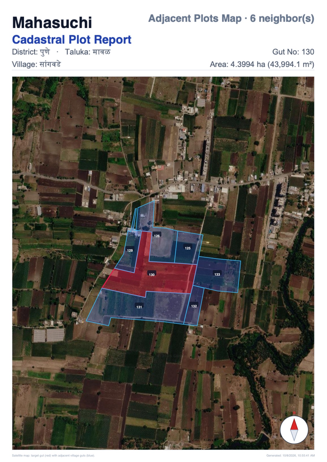
Choose the adjacent plots map to include every touching gut with their numbers — ideal for boundary questions, access roads and layout planning.
Compare with the free government map: Mahabhunakasha guide.
E-Search Form 2.0
View cadastral plot on satellite map
Sample outputs
Sample Document Preview
VERIFIED 130Pune • Maval • Sangawade (सांगवडे) • Gut 130 & Adjacent Guts
Need it for NA, building permission or NOC?
The Gov Plot NOC package adds a landscape NOC sheet and a true-dimension AutoCAD DXF with lat/long corners, so your architect or surveyor can start the site plan immediately. See the NOC AutoCAD drawing →
Frequently asked questions
How can I get a gut number map with measurements?
Open the Map tab, select district, taluka and village, enter the gut or survey number and choose Single Plot Map. You get the plot boundary on satellite imagery and a technical drawing with every side length.
What is an adjacent plots map?
It shows your gut together with every touching neighbouring gut in the same village, with their numbers and side lengths — useful for boundary disputes, access roads and NA layouts.
Is this the same as MahaBhunakasha or mahabhulekh nakasha?
The boundaries come from village cadastral maps, the same maps people open as bhu naksha, MahaBhunakasha or mahabhulekh nakasha. Those sites only show the map on screen. Mahasuchi gives a downloadable PDF with side lengths, a satellite overlay and, in the NOC package, an AutoCAD DXF.
Where does the gut boundary come from?
From the public village cadastral map, the same map Mahabhunakasha shows on screen. Mahasuchi adds side lengths and a file you can download. It is not a government measurement and it does not replace e-Mojani.
Can this replace government measurement (e-Mojani)?
No. It is a reference map from cadastral records. For legal demarcation apply for measurement on e-Mojani. Our map helps you plan and check before that.
What does it cost?
Single plot map ₹699 + GST (₹824.82); adjacent plots map ₹999 + GST (₹1178.82); NOC sheet with AutoCAD DXF ₹1999 + GST (₹2358.82).